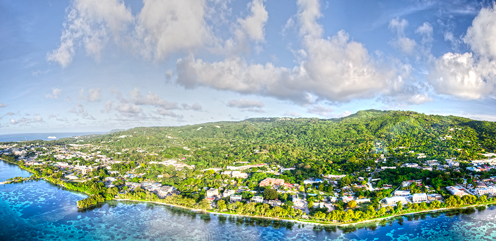
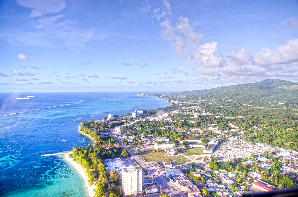
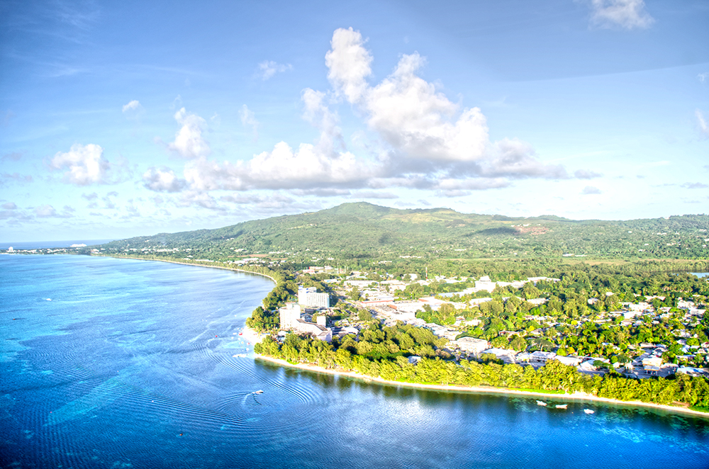
A view of Hotel Street, Garapan, Saipan. What helped me identify areas much easier were landmarks. In this picture, various landmarks can be seen; Hyatt, Fiesta, American Memorial Park, Smiling Cove Marina, Hotel Street, etc. This picture was actually one of several pictures I took continuously. The panoramic stitch didnt come out as I wanted. As a result, I ended up with this beautiful picture.
josequan
January 24, 2015 – Saturday
SaipanA view of Saipan looking East. At this point in the ride, we were heading back to the hanger. It was somewhat difficult taking panoramic photos due to the wind gusting past the helicopter. If you weren’t prepared for it, you could literally drop whatever your sticking out of the cockpit. The timing of the photo was perfect because you could see the vegetation as well as the sea grass beds in the lagoon. Overall, this was a very great experience.
January 22, 2015 – Thursday
UncategorizedJanuary 20, 2015 – Tuesday
SaipanJanuary 18, 2015 – Sunday
UncategorizedJanuary 16, 2015 – Friday
SaipanOctober 15, 2014 – Mt. Tapochau
Long Exposure, SaipanThe weather has been somewhat cloudy in the Mariana Islands. Its probably due to the passing storm, supposedly the strongest storm of 2014 (Typhoon Vongfont). Took a drive up to the highest point on the island, Mt. Tapochau. This drive MUST be done with a 4×4 capable vehicle. The past few months have been rainy, causing the roads to deteriorate.
This picture was taken looking south, looking towards Tinian. You can also see the island of Aguigan (Goat Island) in the distance. I took the picture around 12-1230PM. I was hoping for more blue and less clouds, but Mother Nature can be like that at times. This was a 30 second exposure done with a polarized filter + an ND filter.
August 19, 2014 – Tuesday
Island, Northern IslandsI recently returned from a trip up to Maug, an island apart of the Northern Mariana Islands chain. It is roughly around 330 miles North of Saipan, surrounded by Uracas (North of Maug) and Asuncion (South of Maug). Years ago, the island used to resemble a cone-shaped volcanoe that can be found through out the Northern Mariana Islands chain. After an obvious violent eruption, the remote island transformed into the three islands that can be seen to this day. The topography of the island is very rugged. Steep hills and sheering volcanic ridges pattern all the islands. There are certain areas where vertical ridges protrude outward from the islands.
May 7th, 2014 – Wednesday
TinianPre Cybuk Le’mai (Breadfruit) preparation on the island of Tinian. This type of tree was crucial for the existence of the Chamorro people because it was their “carbohydrate” to fuel and nourish their bodies every single day. There are different ways to prepare this specific stable crop. One way is to simply put it into a fire and let it cook on the outside. Once cooked, its almost like a baked potato but much more tasty. Another way to prepare Le’mai is by cutting off the exposed skin of the crop then chopping it into cubes (as shown in the picture). Boil it in water and coconut milk and then you’ll end up with cybuk. Stay tuned for the finished product!
May 6th, 2014 – Tuesday
TinianI recently made a trip to the island of Tinian to hang out with some friends during the 2014 Tinian Fiesta. Immediately upon arriving at the dock (took my cousin’s boat which was an hour boat ride), we went straight up to the ranch to begin preparing for the evenings feast. This was the fire that was prepared to roast a small-medium sized pig. One of the “local” delicacies is roasted pig. Once the fire is prepared, it is spread around in a circle, surrounding the pig on a spick. The pig is then evenly roasted by turing the spic for several hours. Stay tuned for more pictures!